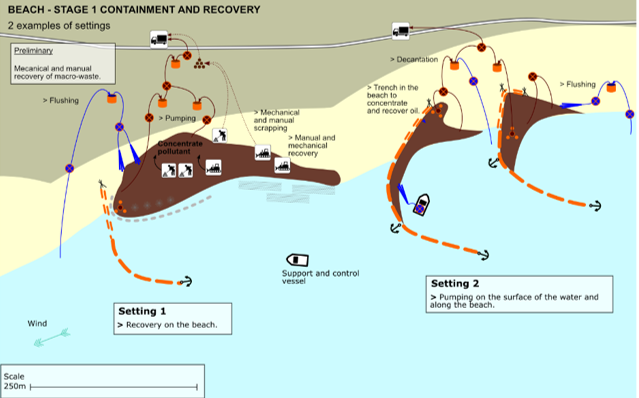
Sensitivity mapping
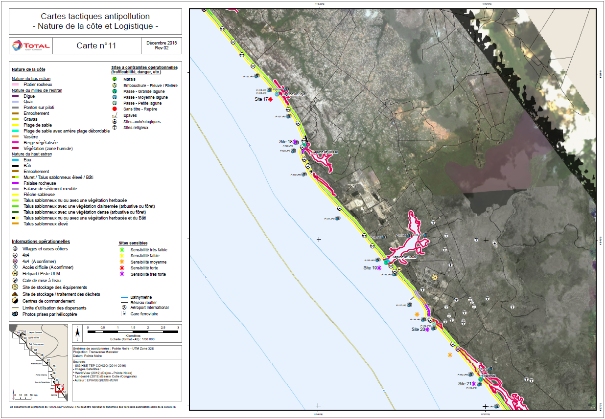
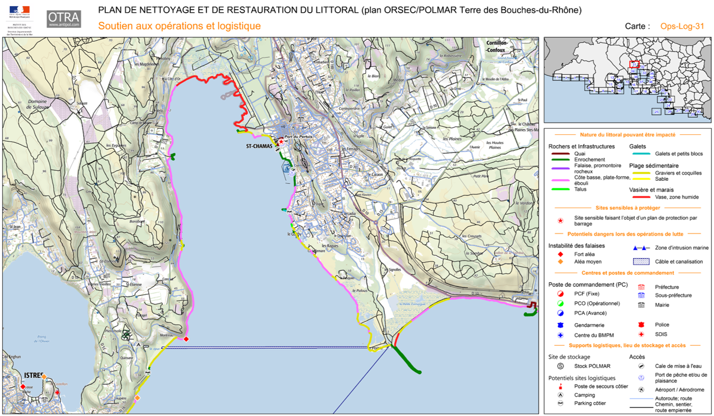
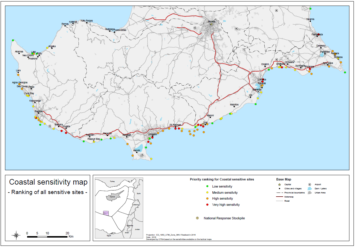
To support the development of oil spill contingency plans, OTRA develops dedicated Sensitivity Mapping adapted to users needs for offshore, coastal and onshore environment.
To develop relevant and efficient sensitivity maps and identify most sensitive sites, requiring priority for protection, OTRA collects, analyzes, processes and archives all information in professionnal geographic databases using dedicated Geographic Information System (ArcGis, Mapinfo, or other).
Why trust OTRA with sensitivity mapping projects ?
OTRA developed the “Sensitivity mapping for oil spill response”: the “Good practice” guideline, which was published by IPIECA Oil Spill Working Group and the IMO OPRC HNS Technical Group.